Interactive map: Is your home or business at risk of flooding?


Storms worse than Storm Desmond could happen in the next decade, the floods boss of the Environment Agency has warned.
Audiences heard the warnings at a public lecture at Lancaster University.
Advertisement
Hide AdAdvertisement
Hide AdAnd now a new interactive map allows you to type in your postcode to find out if you are at risk from either river and sea flooding or surface water flooding.
“It is no longer possible to say these extreme storms are unprecedented,” said John Curtin, Executive Director of Flood and Coastal Risk Management at the Environment Agency.
“What happened last winter was extreme, but it was within the envelope of what we should expect.”
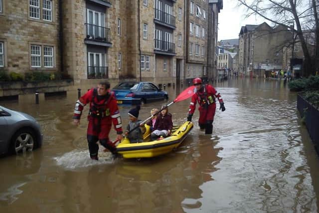
John said modelling by the Met Office suggests the next decade could bring storms with up to 20 per cent more rain than fell during Storm Desmond, which caused devastating flooding in the Lancaster last December.
Advertisement
Hide AdAdvertisement
Hide Ad“The biggest challenge we have is the scale of the risk,” said John, who became interested in hydrology - the study of the movement, distribution and quality of water when he studied Environmental Sciences at Lancaster University in the late 1980s.
“Around five million people – are at risk of flooding. But only eight per cent of people really know they are at risk.”
The Environment Agency is investing £2.5 billion pounds to better protect 300,000 homes by 2021 - not just on flood defences but on soft engineering and catchment management schemes. Find out if you are at risk and how to protect yourself HERE